Innisfil Beach Road Visualizations
Helping residents and City Council visualize the future of Innisfil Beach Road.
Fotenn was retained by The Town of Innisfil to visualize potential development along Innisfil Beach Road, between Lakelands Avenue and 25th Side Road. After successfully completing urban design work and visualizations of the downtown area along Innisfil Beach Road in 2019, The Town reached out to Fotenn with a new assignment, to assist residents and City Council in visualizing what was being proposed in the block’s Zoning By-Law Amendment.
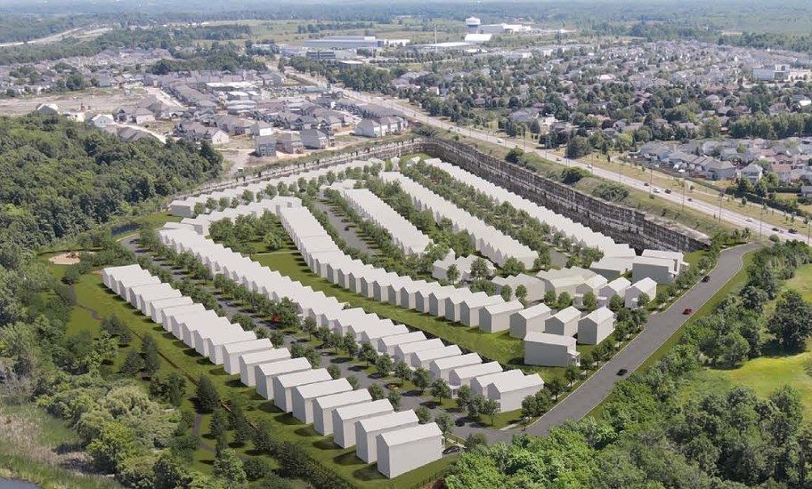
Currently, this section of Innisfil Beach Road is mainly single storey cottages, with large front yard setbacks. We wanted to showcase how the street could transition into a contemporary, mixed-use Ontario mainstreet, providing much needed commercial activity and residential uses across from Innisfil Beach Park and adjacent to Innisfil Beach. A strong vertical rhythm in the facades recognizes the history of Ontario mainstreets while contemporary massing and materials identify the buildings as new development.
Of particular concern to residents was the built form along Lakelands Avenue and the interface with the residential properties abutting the rear yard.
The visualizations helped the Town successfully pass the Zoning By-Law Amendment in December 2020.
Location Innisfil, Ontario
Client Town of Innisfil
Size 4 hectares
Date 2020
Project Tasks 3D VisualizationsProject ManagementMaster PlanningUrban Design Analysis
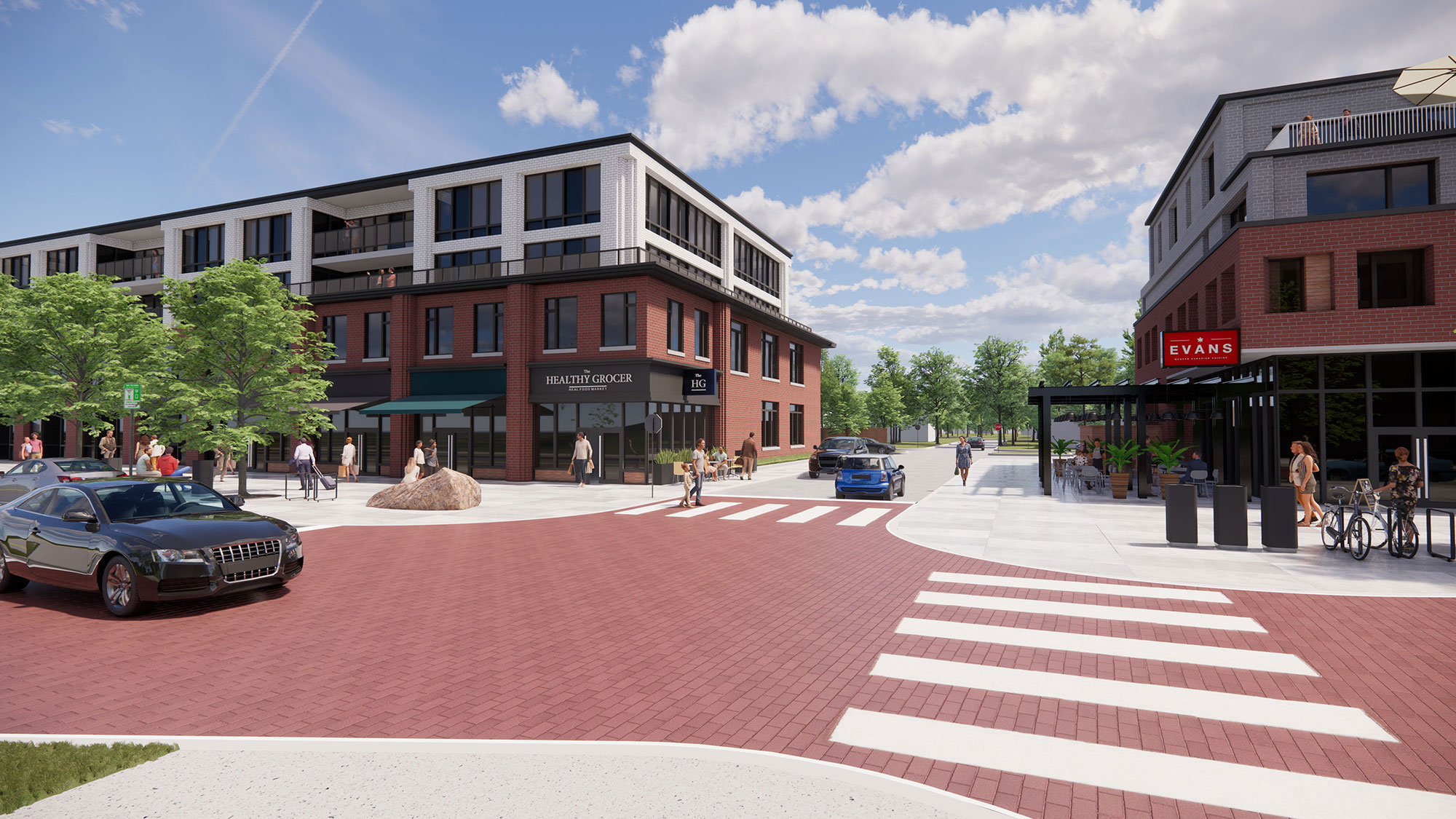 View of the proposed intersection of Innisfil Beach Road and Emily's Place.
Our images helped relieve concerns that residents and City Council had about the new Zoning By-Law Amendment.
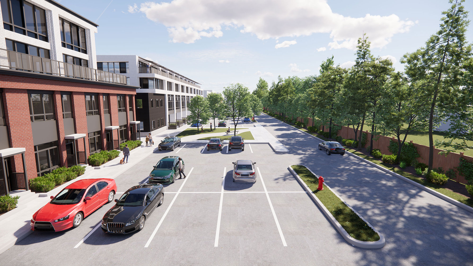 Showcasing parking, a laneway, and a significant landscape buffer in the rear yard.
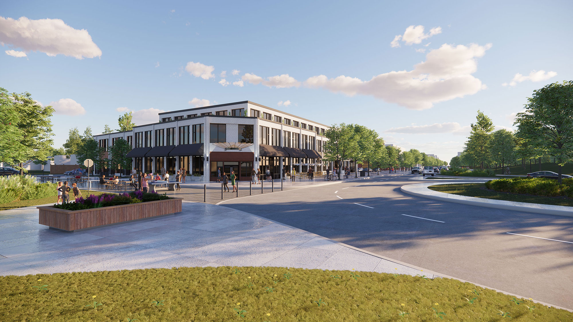 View of the intersection of Innisfil Beach Road and Lakelands Avenue.